44 Forest Plots to Determine Whatcom County Conservation Strategy
A Western Washington University student is surveying state lands to help the Department of Natural Resources decide which mature forests to save and which to log.
By Marco Ortega ·
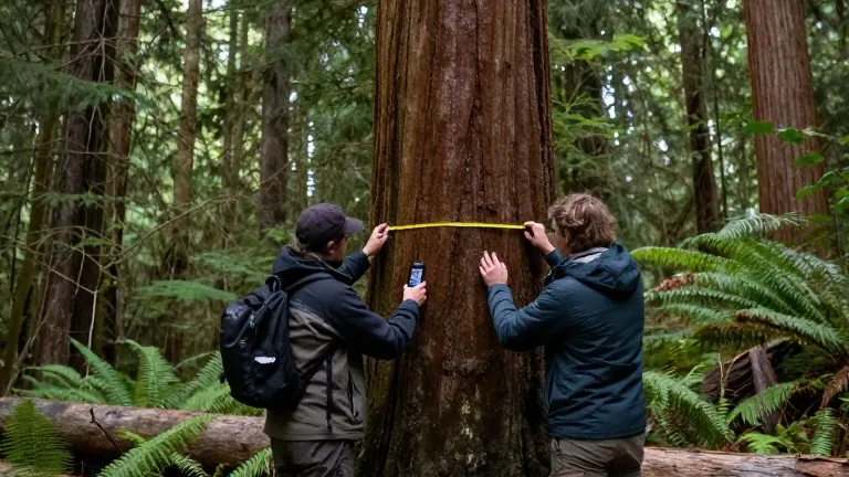
Finley Bell hooked the end of a yellow tape measure into the raised bark of a Douglas fir snag in Olsen Creek State Forest. The tree measured 56.4 centimeters in circumference. Bell called out the number to Aaron Dubbels, who recorded the species and measurement in a smartphone app. The two are one of the few teams actively collecting data on the ground to verify satellite imagery in Whatcom County.
Bell is a second-year graduate student in environmental studies at Western Washington University. He is surveying 44 forest plots managed by the Washington State Department of Natural Resources (DNR). These stands are scheduled for timber sales over the next decade. His research aims to classify which forests are structurally complex enough to prioritize for conservation and which are suitable for harvesting.
The DNR manages 2.1 million acres of state working forests. The agency is legally required to balance timber harvesting with ecological health. In 2025, the DNR launched a plan to identify over 77,000 acres of structurally complex forests. That target was adjusted to 55,000 acres in September 2026. The goal is to ensure that 10% to 15% of state forests reach mature or old-growth status within 70 to 100 years.
Bell used DNR LiDAR data and satellite imagery to locate the study areas. He is now ground-truthing that data by measuring tree diameters, heights, and species composition. He also extracts pencil-sized cores from the largest trees in each plot to determine age. These samples will be analyzed in WWU’s dendrochronology lab. The data will be shared with the DNR, the Legacy Forest Defense Coalition, the Center for Responsible Forestry, and the public.
Professor Aquila Flower, director of WWU’s Spatial Institute and Bell’s advisor, noted that the DNR is currently updating forest management plans. She stated that the agency has collected rapid data but still faces uncertainty regarding the exact location of structurally complex forests. Bell’s research provides the local scientific basis needed for these immediate conservation decisions.
Bell has identified forests that are replanted and dense, often described as beanpole trees with bare dirt floors. He recommends these areas for logging. However, he argues that the forest where he and Dubbels are working should be conserved. It contains a diverse mix of species and a high volume of dead and downed wood, indicating a healthy, regenerating ecosystem. Bell noted that this specific plot is set to be cut in 2033 unless its status changes.
Many of the legacy forests in Whatcom County were selectively logged between the late 1800s and mid-1900s. They were not replanted, allowing them to regenerate naturally. Bell estimates that Whatcom County contains more than 116,000 acres of DNR-managed land. Some of these acres are candidates for inclusion in the state’s new conservation plan.
Source: Salish Current